When first settlers of the New Haven Colony purchased land from the Mattabesech Indians in 1638 it included the territory of Totoket, later called Branford, supposedly for Brentford in the English county of Middlesex. The colony thrived due to productive cropland and its location on the Branford River, which provided the only deep harbor between New Haven and New London. Ships trading lumber, livestock, brooms, and produce for molasses and rum from the West Indies.
Farming was the mainstay of Branford life for over 200 years. The railroad arrived in 1852, bringing small businesses like Branford Lockworks, Malleable Iron Fittings Company, and the Atlantic Wire Company, but the next real injection of financial vitality came from the vacation trade. Twenty summer hotels made Branford a popular resort area including the Indian Point House in Stony Creek, the Montowese House in Indian Neck, and the Sheldon House in Pine Orchard.
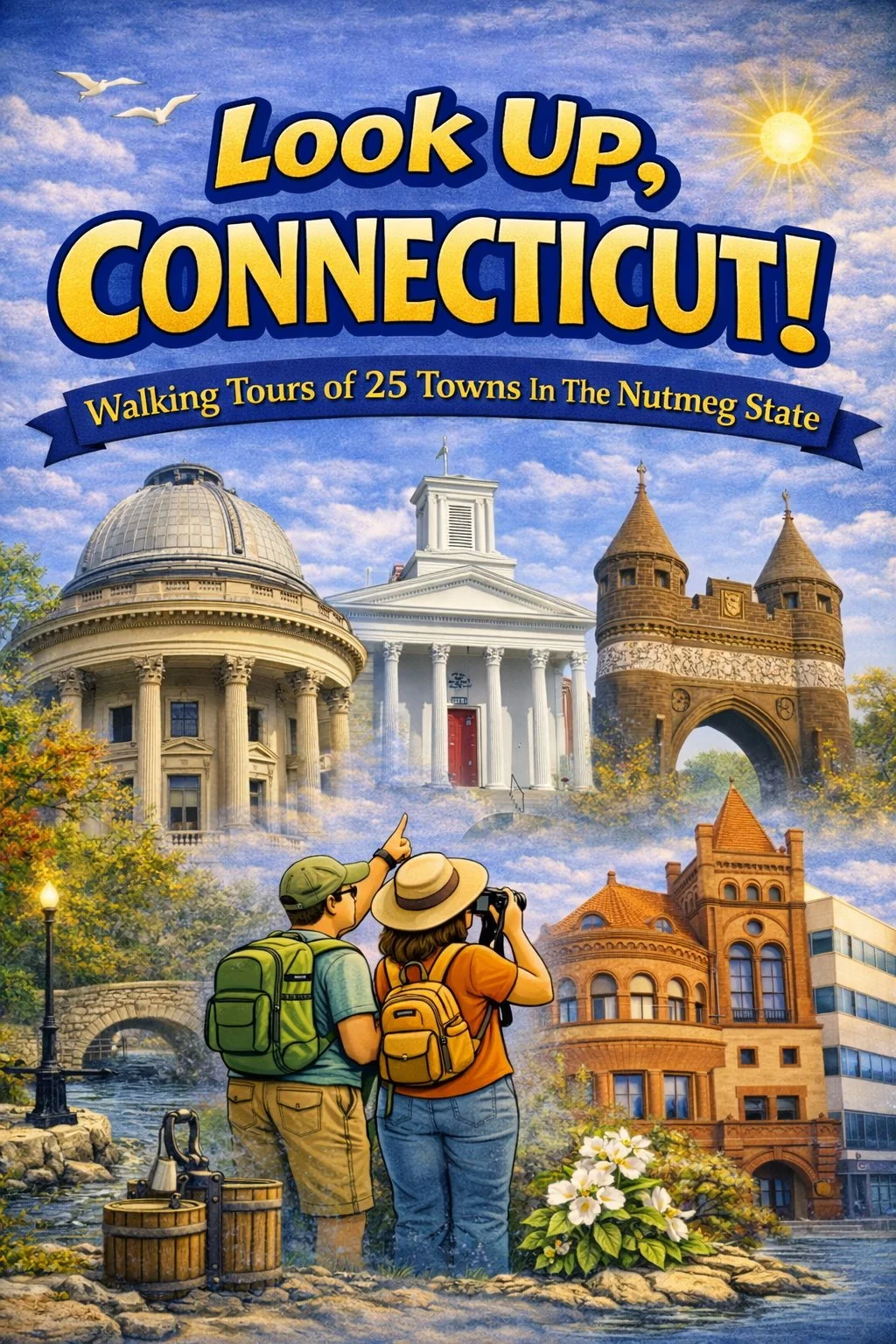
Our walking tour will concentrate on the Green, a triangular open space that is one of Connecticut’s most attractive and the heart of the community since 1699. But we’ll start a block away, in front of a marble building from 1896 that never fails to turn heads in Branford. Consider the lead by a reporter from the Boston Herald for his piece on Branford, “In a very plain village in Connecticut by the sea, nine miles east of New Haven; in a lonesome little town called Branford, which has a malleable iron factory, a lock shop, a quarry and miles of farm patches that produce annually 50,000 quarts of strawberries for the Boston market, there is a public library that cost nearly $600,000!”...
In spite of a slow start, Bridgeport grew into the most populous city in Connecticut. The first settlers wandered over from the neighboring coastal towns of Fairfield and Stratford in 1639 but the city would not be incorporated for another 200 years. The city’s location on the deep Black Rock Harbor fostered a boom in shipbuilding and whaling in the mid-19th century, especially after the opening of a railroad to the city in 1840. In fact, every census report for the next 100 years showed at least a 40% increase in population each decade.
By the 1930s Bridgeport hosted some 500 manufacturing firms churning out almost any product imaginable. Ammunition, chains, rubber goods, typewriters, scissors, toys, hardware, cables, engines, phonograph records, brake linings, sewing machines all shipped from Bridgeport. The first “horseless carriage,” equipped with hard rubber tires and a self-starter, was built here in the early 1890s. The town’s manufacturing base was so diverse it never became known for any one industry.
If Bridgeport was known for anything, it was as the adopted home of America’s greatest showman of the 19th century, P.T. Barnum. Barnum not only moved to town, he served a term as mayor in 1875. Our walking tour will explore the downtown core in an area corralled by the Pequonnock River, I-95 and Highway 8 at the site of an event that was probably much forgotten in Bridgeport a week after in happened on Saturday March 10, 1860, but is still remembered today...
Today Bristol is known as the home of ESPN, the Entertainment and Sports Programming Network that pioneered the concept of 24-hour sports television coverage. But it was another time-related industry that first brought the town to prominence more than two centuries ago.
As early as 1790 it is known that Gideon Roberts was making clocks in town and peddling them around the countryside on horseback. In the adjoining town of Plymouth Eli Terry innovated the compact shelf clock to bring time to those who could not afford tallcase cabinet timepieces. When Terry developed a system that harnessed the power of water and enabled him to mass produce clock gears from wood his explosive success encouraged others to join the industry.
Bristol, which was largely unsettled thanks to its rocky soil, did have that source of water power that made the town a desirable place for would-be manufacturers. In 1822 Chauncey Jerome, who had started his career a few years earlier in Waterbury making dials for long-case clocks, moved his business to Bristol, opening a small shop with his brother Noble, producing 30 hour and eight-day wooden clocks. Before he took the business to New Haven in 1842 the Jerome Clock Company had grown to be the largest in the country. By some repots in the 19th century, Bristol had 280 businesses engaged in the clock business.
Bristol was known as Farmington’s West Woods when the first settlers arrived sometime in the 1720s. In 1742 Bristol became a separate parish within Farmington and a meetinghouse was located on Federal Hill. As Bristol’s industrial identity emerged Federal Hill became home to the town’s economic elite. Their homes spread out down the slopes, first Federal and Greek Revival dwellings and then exuberant Victorian homes. Today Federal Hill has been designated an historic district, one of the largest in the state with nearly 1000 buildings. Our walking tour of this architectural jewel of Bristol will begin at the bottom...
There is nobody named Dan in the founding of Danbury. The eight families who came from Norwalk to found the town in 1684 named it after an English town of the same name. In the early years he better known to most locals as “Beantown” for the quality of beans grown in the area.
Early in the Revolutionary War the town was targeted by the British as the location of American military supplies. The British apparently had reliable information. When they arrived to sack the town the house of those sympathetic to the crown were marked and spared, most everything else, including all the military goods, was burned.
Zadoc Benedict was one who rebuilt after the raid. In 1780 he established the first beaver-hat factory in America here, employing three men in his shop and producing 18 hats a week. From those modest beginnings Danbury rapidly became Hat City, churning out more hats than any city in America. At times one out of every four hats sold in the country was manufactured in Danbury. In the early 1900s it was said that 51 of the town’s 70 mills were in the hat trade, an industry that would be almost killed overnight when John Kennedy was elected president and showed up at the White House hatless
And we won’t see any hats on our walking tour, either. We’ll begin at the old railroad station and follow a route historically taken by thousands of passengers getting off those New Haven Railroad trains...
Derby likes to boast that it is “Connecticut’s smallest city.” But for those who settled at the confluence of the Housatonic and Naugatuck rivers, the advantageous location has always caused residents to think big. The Paugassett and the Pootatuck lived here for centuries but it didn’t take long for European settlers to realize the promise of the power of water. Fur traders from new Haven came first and a trading post was established at Derby Docks by 1642. In 1681 a water-powered grist mill was operating.
In the 1830s Sheldon Smith, an industrialist who made his fortune in New York City, had a vision for developing his land inside the meeting of the two rivers, the area without direct access to the coast. He brought his friend Anson G. Phelps, in on the scheme to create a new industrial community they first called Smithville and the Birmingham. Smith and Phelps convinced the local government to build the street system while they supplied the planning, including setting aside two acres for a public green, and a new copper mill. By 1870 a great dam was completed on the Housatonic River that provided power to this burgeoning industrial hub but also permanently erased Derby’s character as a fishing and farming community.
The various villages and towns and jurisdictions around the historic junction of the Housatonic and Naugatuck rivers came together and were chartered as the city of Derby in 1893. The Borough of Birmingham thus became “downtown” and that is where our walking tour will take place. We’ll start at the historic library and work our way down to the Housatonic River where the Derby Greenway links two rivers, three cities and six bridges...
At the time of American Revolution Farmington was the 10th most populous town in the colonies. It was founded back in 1640 when a handful of English settlers from nearby towns and bought territory from Sequasin, chief of the Tunxis Indians. Under an agreement, the settlers ploughed the land and the Indians cut wood for fuel and traded their corn and hides. Eventually the Tunxis Indians adopted the culture of the settlers, joining them in the town’s churches and schools.
The town was incorporated as Farmington in 1645 by an act of the Connecticut General Assembly and it was an apt monicker as small farmers dominated the community for well over a hundred years. Following the Revolution the town began to bustle with industrial activity - linen and leather goods and muskets and clocks and buttons were all manufactured here. The burgeoning trading center boomed with the opening of the Farmington Canal in 1828, linking New Haven to Massachusetts.
Mercantile goods weren’t the only thing flowing through Farmington. The town became an important stop along the Underground Railroad with at least eight safe houses operating in the first half of the 19th century. So fervent were Farmington’s abolitionist, in fact, that the town came to be known as “Grand Central Station.” In 1839, after 53 Africans bound for slavery in Cuba took over the schooner Amistad and sailed into Connecticut many were brought to Farmington to await their fate, which was a return to Africa.
A combination of landslides and railroads brought an end to the canal by 1848 and the town gradually reverted to its historical roots as an agricultural community. Meanwhile, its vast area was divided to produce nine other central Connecticut communities - so many that Farmington became known as the “mother of towns.”
Our walking tour will focus on the historic center of Farmington studded with historic homes reaching back 200 years and more, where we’ll see what George Washington saw when he supposedly called Farmington a “village of pretty houses.” But first we’ll start down by the Farmington River where there is an historic mill and a convenient parking lot...
Glastonbury is said to possess more pre-1800 Colonial houses than any other town in Connecticut. The area on the east bank of the Connecticut River was settled early, as part of the Town of Wetherfield. In fact in 1695 the “Glistening Town” became the first town in the state to be creating by splitting away from an existing town. The first division of land was in narrow strips of land running three miles eastward from the river to provide each owner an assortment of the the several qualities of the land rather than favor a few with the best land.
From the start there were two town centers, known today as Glastonbury and South Glastonbury. The first house was in South Glastonbury, the first meeting house in Glastonbury. The town was a typical Connecticut river town in its early days; the water provided power for mills and supported an energetic shipbuilding trade. Most of the economy was pegged to the crops that were grown nearby, tobacco for export and foodstuffs for local trade. Modest industries took hold - textiles and metalworking and tanneries.
And then.
The railroad failed to come. Development no longer continued to grow apace in Glastonbury. It evolved into a residential suburb of Hartford. There was no need to replace all that housing stock from the 1700s with bigger and more modern buildings.
Glastonbury’s Main Street initially was an Indian trail running from East Hartford south along the east bank of the Connecticut River, eventually leading to the mouth of the Thames River on Long Island Sound. It was adopted as a town street in the last decade of the 17th century and has been maintained for three centuries. Its layout has not been compromised; the wide thoroughfare is flanked by grassy strips and sidewalks from which the houses are comfortably set back. There are no parking spaces for cars along the street to intrude on its centuries-old feel. Our walking tour will begin at the edge of encroaching suburbia and quickly disappear into a leafy streetscape of Dutch and English Colonial architecture...
For a town whose reputation is often pegged to money it is perhaps no surprise that even after it was purchased by the British in 1640 the settlers of the town preferred to remain a part of the Dutch colony of New Amsterdam, a colony swayed first and foremost by all things financial. Those English buyers did well by themselves in the pocket book as well. For the cost of 25 coats, Daniel Patrick and Robert Feake picked up all the land between the Asamuck and Potommuck brooks.
For 200 years farming was the main activity in Greenwich, with a sprinkling of mills. Industry never really took hold in the town. There was a saltworks and an ironworks and shipbuilding but nothing that would leave a lasting mark. What would, however, leave an indelible impression on Greenwich was the railroad which arrived in 1848. At first New Yorkers used the easy access to Greenwich for a summer escape. When the humidity started to rise the rooms would fill at Ye Old Greenwich Inn, The Castle and The Crossways Inn in Old Greenwich, and The Maples Inn, The Lenox House and the Edgewood Inn.
Then, rather than rack up hotel charges the wealthy came to live. There was the “Tin Plate King,” Daniel Gray Reid. And the “Sugar King,” Henry O. Havemeyer. The “Mattress King,” Zalmon Gilbert Simmons, built the showiest estate of all. the families of Morgan, Rockefeller and Dodge all found their way to Greenwich. By the 1920s any list of richest American towns always had a place reserved on it for Greenwich. Our walking tour will begin in a cluster of civic buildings and then wander up the “Rodeo Drive of the Northeast where retail rents command more than midtown Manhattan per square foot...
The early settlers - that would be 1646 - came to Groton between the Thames and Mystic rivers to farm. But there was never much living to be scratched out of the rocky soil and hilly terrain. It did not take long for shipbuilding to become an important early industry. Large ships were floating out of the Groton yards as early as 1724. Beginning with the Revolutionary War, when a 36-gun frigate was built here, the government came to depend on Groton shipbuilders. In the War of 1812 many privateers were fitted out to run British blockades. During the Civil War the ironclad Galena was constructed at West Mystic and after the war, in 1868, a Navy Yard was established on the Thames River. During World War I it was officially commissioned as a submarine base and in World War II Groton churned out 74 diesel submarines for the Navy. In 1954 the world’s first nuclear-powered submarine, the USS Nautilus, launched from Groton, by then truly the Submarine Capital of the World.
Groton men didn’t just build ships, they sailed them. Local mariners racked up some of the most impressive sailing records of the 19th century. Captain Joseph Warren Holmes doubled Cape Horn at the tip of South America 83 times, more than any other man afloat. On one trip, after a year at sea on his Pioneer, Captain Ebenezer Morgan returned with 1,391 pounds of whale oil and eleven tons of bone which he sold for a profit over $100,000, considered a record voyage.
In 1655 the first settlers colonized the east bank of the Thames River; when Groton became a separate town in 1705, the east bank was called Groton bank. In the waning days of the American Revolution, in late summer 1781, a British raiding force under the direction of turncoat Benedict Arnold overwhelmed a cadre of militia defenders on the heights overlooking the Thames River here in the only major battle of the war in Connecticut. Arnold sacked the town and New London across the river.
This is where our walking tour will take place, in a small sliver of the town of Groton, about 12 square blocks. We’ll start at one of the two museums in town, where there is abundant parking down byhe Thames River and a view of the Gold Star Bridge, a pair of steel truss bridges that are the longest span in Connecticut...
The Dutch were the first Europeans to set up camp at the confluence of the Connecticut and Park rivers when fur traders from New Netherlands established a post in the early 1620s. The first English settlers arrived in the persons of Thomas Hooker and Samuel Stone in 1635 and the scattering of log houses took the name of Stone’s English birthplace, Hertford.
A half century later Hartford became one of the first trouble spots in the American colonies for the English crown. In 1687 Sir Edmund Andros, the English governor, demanded that the town’s citizens surrender a 25-year old charter granted by King Charles II that gave the colony its independence. Instead the locals hid the charter in the hollow of a large oak tree for about three days. Today a stone marker remembers the Charter Oak a short distance east of the original town center of Main and Buckingham streets.
Hartford has been a capital town for over 300 years but it shared that distinction with New Haven for well over half that time. Until 1818 each town held a legislative session each year and then began hosting the legislature on alternate years. Finally by vote of the citizenry in 1874 Hartford became THE capital of Connecticut.
Hartford’s reputation is as the “insurance capital of the world” but there has always been room in its commercial life for more than underwriting and actuarial charts. It historically has been an agricultural market and tobacco sorting and packing was an important industry. Hartford manufacturers produced typewriters, tools, firearms (Samuel Colt made his revolvers in a brick armory at a bend in the Connecticut River), and the creation of gold leaf among many others. That first insurance policy, by the by, was written in 1810 by the Hartford Fire Insurance Company.
By the 1870s Hartford was said to have the highest per capita income in America. In 1868, Mark Twain, who would move here, exclaimed: “Of all the beautiful towns it has been my fortune to see, Hartford is the chief.” Our walking tour will begin in America’s first public park, which was opening about the time Twain was making his remarks. We’ll see some of what he saw and plenty more...
What is today the city of Meriden was in 1661 the beginnings of Jonathan Gilbert’s farm when he was granted 350 acres. Gilbert, a resident of Hartford, had been born on Meriden Farm in the English County of Surrey. It would not be until 1806 that the town would be incorporated, by which time the callow sprouts of industry had appeared in the form of pewter goods, especially buttons.
One of those pewter shops was established in 1808 by 24-year old Ashbil Griswold. Under Griswold’s leadership, Meriden soon became a leading center in the production of Britanniaware, pewter, and silverware. Because of its more durable qualities, Britannia had replaced pewter in most American homes by the 1850s and in 1852 many of the small shops banded together to organize the Meriden Britannia Company.
By the 1890s, Meriden Britannia had established branches in Canada and London and sales offices in Chicago, New York, and San Francisco. Assuming a leadership role, Meriden Britannia convinced other small independent silver shops in the Connecticut area that cooperation was more efficient. The International Silver Company was the result and Meriden was the “Silver City” - the center of silverware production in the United States.
International Silver left town in the mid-1900s and so too did many of Meriden’s traditional businesses. Our walking tour of downtown will pass many holes, including the International Silver plant on State Street, as we investigate what remains of the city’s makeover. We’ll start at a triangular intersection that displays some of Meriden’s most striking civic, educational, ecclesiastical, fraternal and cultural architecture...
The first settlers from Hartford and Wethersfield found this spot on a big bend in the Connecticut River in 1650. They laid out a street above the flood plain that ran parallel to the water, today’s Main Street, and named the village Middletown because it was more or less midway between Saybrook and Hartford on the river. The fertile alluvial plain and the favorable geography allowed the town to flourish immediately. By 1756 Middletown, with its population of 5,664, was the largest and wealthiest town in the state of Connecticut. It was Connecticut’s most important port because it was the leading shipping center for the West Indies trade. Later it was a key player in the China trade.
Other Middletown citizens were busy on the land with carpenters and shipwrights and stonecutters and artisans. A local mine produced lead. Middletown rivaled Boston and Philadelphia as a pewter center. Unfortunately inland sea ports faced a disadvantage with the arrival of larger sea-going ships and Middletown’s trade slipped away in the 19th century. Wesleyan College was established in 1831 which helped attract other cultural institutions. As the town’s industry diversified, Main Street grew ever more commercialized and residents moved up the hill to High Street.
Through Middletown’s connections with three railroad lines, the Air Line, the Berlin Branch and the Connecticut Valley, the city was linked to local and national networks of rail transportation by the early 1870s. This encouraged the growth of both established industries which continued to serve regional needs and specialized industries supplying national markets. Rubber was an early product line here. And pumbs. And silverware. And typewriters. The U.S. Census of Manufacturers listed 131 firms in Middletown in 1870.
Our walking tour will start on Main Street where most of the commercial buildings are of 20th century vintage and work our way to High Street that is lined with high-style 19th century mansions, most of which have been absorbed into Wesleyan College...
New Britain’s reputation as the “Hardware City” began about 1800 when James North and Joseph Shipman started the manufacture of sleigh bells. Thwarted by the town’s location with no navigable rivers and inadequate water power would-be manufacturers had to content themselves with small operations for the peddler trade producing tools and locks and other light metal articles. In 1831, 28-year old Frederick Trent Stanley teamed with his bother William to produce some of the earliest house trimmings and locks in America. This business sputtered along for a time until the Panic of 1837 crippled it fatally.
Frederick Stanley next surfaced in New Britain in 1843 in a nondescript one-story wooden structure that had once stood as an armory during the War of 1812. here Stanley would lay the foundations for the most famous toolworks in America.
The Stanley Bolt Manufactory was one of hundreds of little manufactories struggling to make a go of it, the majority of which were one-man shops. The only thing setting Stanley apart was a single-cylinder, high pressure steam engine shipped up from New York and carted by ox to the little wooden shop. Stanley’s was the only automated shop in the region. Stanley peddled his bolts by horseback and wagon across the back country. His tiny business must have impressed his neighbors because in 1852 five friends pooled the staggering sum of $30,000 to form the Stanley Works that has helped shape the town to this day, not in the least by attracting waves of European immigrant workers to New Britain.
By 1900 the population of the town, incorporated only 50 years earlier, was cresting at 30,000 with half being foreign or of foreign parentage. Our walking tour of the Hardware City will examine buildings from this period almost exclusively, several preserved after glorious restorations...
The area which today is New Haven was the home of a small tribe of Native Americans, the Quinnipiack, who built their villages around a broad, but very shallow harbor, at the confluence of the Quinnipiac, Mill and West rivers. They harvested seafood, hunted with bow and arrow for food and furs and grew maize, the staple of their diet.
Their lives changed forever on April 24, 1638, when a company of five-hundred English Puritans led by the Reverend John Davenport and Theophilus Eaton, a wealthy London merchant, sailed into the harbor. The newcomers were looking for a place to practice their religious beliefs but also came with an avaricious eye towards controlling the trade from the Long Island Sound down to the Virginia colony. Within a year the settlers had laid out eight streets in a grid of four streets by four streets creating what is now commonly known as the “Nine Square Plan,” making New Haven one of the first planned towns in the New World.
Plans for a commercial empire were scuttled early on, however, when the town sent its first fully loaded ship of local goods back to England in 1646. The ship never reached Europe and disappeared with all the hopes of its financial backers in Quinnipiac, as the town was know. By the time it became New Haven in 1678, the colony lagged far behind Boston and the newly conquered town of New Amsterdam, renamed New York.
Instead, New Haven evolved into more of a cultural and educational center. It was made co-capital of Connecticut in 1701, a status it maintained with Hartford all the way into the 1870s. In 1716 the tiny Collegiate School of Connecticut arrived in town from Old Saybrook. Two years later, in response to a request from Cotton Mather on behalf of the institution, Welsh merchant Elihu Yale sent a carton of goods which the school sold for 800 pounds sterling and so it became Yale College. Today Yale University is synonymous with New Haven and is the city’s largest employer.
There was industry as well. Locks and hardware, pork products, clocks, and especially, Winchester repeating rifles bore New Haven trademarks. Among the odds and ends invented in New Haven were the corkscrew, the lollipop and the steel fishhook. But smokestacks and factories were never an image evoked by New Haven. The city had the first public tree planting program in America, producing a canopy of mature trees that gave New Haven the nickname “The Elm City.”
New Haven has been in the forefront of urban renewal in recent decades and lost many of its historic buildings and Dutch Elm disease claimed the lives of many of its big shade trees. But trees have been replanted, millions of dollars spent to spruce up buildings that weren’t knocked down and out walking tour will begin in the center of the 16-acre New Haven Green, a National Historic Landmark, and the outstanding feature of downtown...
When a group of Puritan families under the the direction of John Winthrop, Jr. arrived here in 1646 they found one of the deepest harbors on the Atlantic coast, courtesy of an ancient flooded river valley. The prospects for the new location were so promising the village soon was named New London and that river was called the Thames.
The sea would bring both wealth and heartbreak to New London. During the Revolutionary War more troublesome privateers operated from this port than any other in New England. It has been estimated that some 300 British cargo ships were captured by New London vessels. Such activity did not escape the attention of the crown and even though the war was winding down in September 1781 a British Tory fleet under the command of Benedict Arnold sacked the town. To New London’s misfortune, Arnold spent much of his childhood in the town and knew the terrain. His raiding party destroyed 150 buildings. Arnold claimed that most of the destruction was the fault of accidental fires but townspeople contended he stood at Ye Ancientist Burial Grounds viewing the flames, “with the apparent satisfaction of a Nero.”
After the war ended a very different trade came across New London wharves. The whaling industry traces its beginnings to May 20, 1784 when the Rising Sun shoved off for the fishing grounds off Brazil and returned the next year with more than 300 barrels of whale oil. For the next 125 until the last whaling schooner, the Margaret, left port in 1909, New London rivaled New Bedford, Massachusetts as the whaling capital of the world. By 1850, a million dollars a year worth of whale oil and bone was being recorded at New London customs.
Whaling was not the only industry of note in New London. Thomas Short established Connecticut’s first printing press here in 1709. His successor, Timothy Green, produced almanacs that eventually spawned The New England Almanac and Farmer’s Friend, an influential resource for more than 175 years. New London’s presses also produced America’s greatest playwright, Eugene O’Neill, O’Neill’s theatrical New York family summered here where he acquired an abiding love of the sea and wrote for the New London Telegraph.
Our walking tour of New London will concentrate in the downtown historic district where we’ll see houses remaining from the city’s great whaling captains, buildings by great 19th century architects, and the working place of a great Connecticut patriot...
The village of North Stonington is on land originally granted to Amos Richardson in 1667, which he gave to his son Samuel on his 21st birthday, April 20,1682. The first settlers to North Stonington were Ezekiel Main and Jeremiah Burch, who in 1667 established settlements in the areas which became the village of North Stonington and Clark’s Falls, respectively. Main, formerly of Massachusetts, had served in the King Philip’s War, and received in return for his military service a land grant. Burch, on the other hand, had been a blacksmith in England before making the crossing to America and establishing a land stake.
North Stonington and its mother town on the coast, Stonington, come by their names honestly. the land was sculpted by retreating glaciers 10,000 years ago and the land is studded with their souvenirs. The southern part of town is a little more amenable to farming and was probably settled first but it didn’t take long for most settlers to realize their fortunes were better pegged to power latent in the town’s rivers and streams. Samuel Richardson, an early farmer and extensive landowner, had a mill going by 1702. There would be enough mills humming along the Shunock River that the village would adopt the name “Milltown.” In the early 1800s it was inhabited by 210 people and included a gristmill, sawmill, fulling mill, cotton mill, and wooden mill, all of which were powered by the Shunock and Assekonk Rivers.
At a town meeting on April 5,1806, it was voted to divide the Town of Stonington into two separate towns. The division of the towns was based on an ancient line creating a North Religious Society of Stonington nearly one hundred years prior to the separation of the country from Great Britain. The line was important because it delineated which of the two Congregational Churches people would attend. It was also decided that the new town to the north of the line was to be called Jefferson in honor of President Thomas Jefferson. The General Assembly of Connecticut confirmed the vote in May of 1807 naming the town, not Jefferson, but North Stonington, because the North Religious Society there had been so named in 1720 and the name had been become identified with the vital interests of the area.
These days the settlement along the Shunock River is known as North Stonington and it rests sleepily on the National Register of Historic Places. Our walking tour will begin at the water and explore both sides. There are no sidewalks but not much traffic either...
Roger Ludlow is the “Father of Norwalk” since he bought the land west of the Norwalk River from Mahackemo, chief of the Norwalke Indians, in 1640 or 1641. But Ludlow was merely an agent, Deputy Governor of Connecticut, not an adventurer or settler. The purchase may have been to thwart potential Dutch expansion plans out of New York. Ludlow stayed in the town of Fairfield and left the dirty work of clearing land and carving out a life in new territory to others.
Those first settlers migrated down from Hartford in 1649 and the first crops were planted. Flax and hemp used for linen and rope became an early important crop. In the island speckled waters they found natural beds of oysters, the foundation of an industry that would help power Norwalk’s economy for three centuries.
The Revolutionary War did not treat Norwalk kindly. In 1779 British forces swept along the Connecticut coast in an effort to cripple American naval activity in Long Island Sound. General William Tryon arrived with 2,600 troops on July 10 and quickly dispatched the resistance from a few hundred Patriots. Tryon’s troops burned the town to the ground; it was said only six houses were spared. Included in the carnage were flour mills and saltworks. After the Revolutionary War, many residents were compensated for their losses with free land grants in the Connecticut Western Reserve in what is now Ohio; this later became Norwalk, Ohio.
It did not take long for the local industry to rev up again, however. Within a few years the first kilns were fired that would churn out the pottery for which Norwalk became famous. Many of the pieces of red, yellow, brown and black, mostly of simple design, are collectors’ pieces today.
In January 1849 the New York and New Haven Railroad began operating, bringing railroad service to Norwalk. Within a few years the town was linked to Danbury by rail. The iron horse brought unwanted notoriety in 1853 when the nation’s first railroad bridge disaster occurred over the Norwalk river. The engineer failed to observe an open drawbridge signal and the locomotive, two baggage cars and two-and-a-half passenger cars plunged into the river. Forty-six people drowned or were crushed to death with many more injured.
In 1913, the cities of Norwalk, South Norwalk, the East Norwalk Fire District, and the remaining parts of the surrounding Town of Norwalk consolidated into the present day City of Norwalk. The resulting city on both sides of the Norwalk River became the sixth largest in Connecticut. Our walking tour will focus on South Norwalk, the historic SoNo district, where the original town began...
Geography has always been a blessing and a curse in the history of Norwich. Norwichtown was founded in 1659 by settlers from Old Saybrook and a wharf was established on Yantic Cove to supply what became a farming community. But a better harbor was downstream at the head of the Thames River where Yantic and Shetucket rivers came together so a public landing was built there in 1694. Now isolated from their shipping dock it was now necessary to build roads to reach the young settlement. One, the East Road is today’s Broadway and another, the West Road, is Washington Street today.
With access to a reliably deep waterway Norwich goods were soon flowing directly to England and the West Indies. When the Revolution came in the 1770s the town’s inland location enabled it to avoid the brunt of English retaliation suffered by the coastal towns. Norwich parlayed this circumstance into a burst of prosperity producing, among other goods, armaments. By the late 1820s and 1830s Norwich industry was in full swing. Steamboats chugged up and down the Thames and there was regular service to New York City. The railroad arrived early with the Norwich-Worcester Railroad building into town in 1832. But the inland location that had brought shelter proved a detriment as the more convenient coastal town attracted more of the industrial concerns over the next 100 years. Most of Norwich’s economic engine would eventually drift away. In the half-century after the Great Depression not even a dozen new buildings were constructed downtown.
The physical topography around Norwich also wielded the proverbial double-edge sword. Hills rise quickly from the rivers forcing the downtown to develop along crowded, crooked streets but the views from the impressive mansions that the wealthy built around the crests of those hills helped Norwich earn the sobriquet, “The Rose of New England.”
Our walking tour will explore the Chelsea District, the downtown that grew up around the public landing built on the Thames River more than 300 years ago and we’ll include a stroll up one of Norwich’s hills through a residential section of stately mansion and leafy streets. But first we’ll start down by the water where abandoned buildings have been cleared, open space has been developed and plentiful parking awaits...
The English first settled on the western side of the mouth of the Connecticut River but it did not take long for the settlers to wander to the east bank. The town of Lyme was set off from Saybrook on February 13, 1665. The first settler, Matthew Griswold, took the name from the port in England from which he had sailed, Lyme Regis in Dorsetshire. Or so it is assumed.
Old Lyme has always been shaped by the sea. Among the early industries were fishing, shipbuilding and the manufacture of salt, of which Old Lyme was the state’s only supplier. At one time, it was said, every house in Old Lyme was occupied by a sea captain.
Those industries are all gone from Old Lyme, which was separated from its fellow Lymes in 1855. The sea captains are all gone, too. In their place are artists and tourists. The artists first came when Miss Florence Griswold opened her boarding house doors to a group of artists in 1899 and founded the Lyme Art Colony. The tourists come every summer when the year-round population of the town doubles.
Our walking tour will travel down Lyme Street and come back again, all under leafy circumstances; if we have to see a town twice we could do no better than the classic New England town of Old Lyme...
Old Saybrook’s location on a point at the mile-wide mouth of the Connecticut River was arguably the most geographically desirable location in Colonial Connecticut. And its possession was a constant source of contention in its early days. the Dutch, who set up a trading post here in 1623 and the British, who followed a few years later, jockeyed for its ownership until a show of force by new governor John Winthrop in 1635 discouraged Dutch interests forever. And of course, the Indians who were living here were not anxious to leave, instigating the Pequot Wars. Even after Denmark surrendered New York to the English, Old Saybrook was the target of a take-over attempt by its British governor, Sir Edmund Andros.
Through it all, Old Saybrook emerged as the fourth oldest town in Connecticut and as the settlers spread out the towns of Lyme, Old Lyme, Westbrook, Chester, Essex and Deep River evolved form the mother town. Yale University was founded in Old Saybrook as the Collegiate School for the education of ministers in 1700. The Saybrook College of Yale University Seal is used as the Town logo on its letterhead and town-owned vehicles.
Because of its location at the mouth of the river, Saybrook became an important center for coastal trade and for trans-shipment from river boats to ocean ships. In the 1700’s and 1800’s along the shore of North Cove, and even extending out onto the river shore near the cove’s mouth, were built many warehouses and wharf’s to handle the ships and their cargoes. But otherwise industry never gained an enthusiastic foothold in town.
Instead the seaside location lured the tourist trade early on. The first resort development was recorded in 1870 when a company was formed to build cottages and hotels at Lynde’s Farm, known as Light House Point where it was said the temperature seldom rose above 84 degrees and “sea breezes blew from three points on the compass.” This development set a new standard for seaside resorts by restricting building specifications and prohibiting amusement concessions. One of the new breed of leisure class to seek out those sea breezes was Dr. Thomas Hepburn who brought his family to the Fenwick area of Old Saybrook in 1912. His daughter Katharine, was not yet five at the time.
Our walking tour of Old Saybrook, up and down Main Street, won’t actually see the historic waters but won’t be so far away as to miss the salt air when the breezes are up...
When this pocket in the Litchfield Hills was settled in the 1730s it was known as Mast Swamp because the tall pines that blanketed the area were much used in shipbuilding. The tumbling waters of the Naugatuck River provided ample water power for a mill that was built in the early 1750s but few residences followed. One family that did settle in town was the Browns and John Brown, who would become a fiery abolitionist and one of the most divisive figures of the 19th century, was born here on May 9, 1800.
In 1813 the Frederick Wolcott of Litchfield purchased some riverside property and erected a woolen mill. This enterprise did attract a sizable workforce and the community that sprung up around the mill became known as Wolcottville. It would not become Torrington until 1881.
In 1834 Israel Coe and Erastus Hodges began the construction of rival brass mills; Coe was making the first brass kettles in America, using a hammering technique known as the battery process. This was the beginning of the brass industry in Torrington, an industry that would later be synonymous with the entire Naugatuck valley. The Naugatuck Valley Railroad arrived in 1849 and the manufacturing ethos would hum for the next 100 years, attracting waves of European immigrant workers. Medical needles, woolens, lathes, skates, electrical goods and hardware all helped to place Torrington in the front rank of Connecticut industrial towns.
In August 1955 the Naugatuck River breached its banks during hurricanes Connie and Diane and the severe flooding destroyed the center of town that had been old Wolcottville, killing seven and causing $13,000,000 in property damage. In the years since the town has recovered and rebuilt but many of the workers that used to man the Torrington manufacturing plants began to commute to Hartford and Waterbury and Danbury. One of the steps taken to breathe life back into downtown Torrington was to recognize and preserve its architectural and historical heritage. Our walking tour to observe the fruits of this effort will begin on the banks of that fickle Naugatuck River, where a municipal parking lot awaits...
The Indians who lived near here called it Mattatuck, roughly translating to “badly wooded region.” The English named it Waterbury, choosing to focus on the positive - the abundant streams - and not the rocky, treeless hills. Nonetheless, after it was settled as part of Farmington in 1674 no one rushed down to move here. When two scouts conducted a four-day survey in 1686 they concluded that the land could support “but 30 families.” They weren’t too far wrong. One hundred and fifty years later the population of the town had scarcely scraped over 2,000.
But the dire prognosticators did not reckon on brass. There were button shops around town by the late 1700s but it wasn’t until the 1820s that the brass industry began to take off in Waterbury. Englishman James Croft came to town to produce a striking orange tint favored by Americans on their brass buttons in 1820 and the ensuing decades would bring better techniques and advances in the craft. Waterbury brass was used in coins, ammunition casings, screws, tacks, clocks, cocktail shakers. By the end of the 1800s the town was truly “Brass City” - more than a third of all the brass manufactured in the United States shipped from the Naugatuck Valley.
By World War II the lightly regarded townsite had surpassed 100,000 people and was one of the ten largest cities in New England. Plastic and aluminum eventually came to replace many of the uses for brass and the big manufacturers moved away in search of cheaper labor, no longer in need of the mechanical talent that was once synonymous with Waterbury.
A fire in 1902 wiped away much of the downtown so our walking tour will dial back to an image of an industrial American city from the early 20th century at the zenith of its importance. A wealthy, rebuilding Waterbury attracted many important American architects who left a monumental footprint in the city, most notably Cass Gilbert, who designed the Woolworth Building in New York as the tallest building in the world. In Waterbury Gilbert designed a landmark hotel, City Hall, a bank, a private club and a head-turning headquarters for a brass company. But first we’ll start in the middle of the town green around which the earliest settlers built their houses when no one thought Waterbury would ever amount to anything...
John Oldham was one of the members of the Massachusetts Bay Colony more interested in the commercial possibilities of the New World than the religious freedom it offered. Accused of plotting a revolt, he was banished from the colony in 1624. As a trader Oldham sailed to Virginia and back to England. In 1634 he led a group of men known as “The Ten Adventurers” up the Connecticut River to establish the first English settlement in the valley. Oldham did not settle here, however, and in 1636 he was murdered by Naragansett Indians on Block Island, Rhode Island.
Those who stayed in Wethersfield found land richly endowed with deep, fertile soil, a legacy from the glaciers and the annual flooding of the Connecticut River. The first bounty from this agricultural treasure was an onion with a dark red-hued skin that became world-renowned as the Wethersfield red onion. Their pungent scent caused outsiders to know the little village as Oniontown. Soon Wethersfield became America’s first major seed-producing area.
Industry-wise, shipbuilding brought the first prosperity to town. The first ship said to be built in Connecticut, The Tryall, was constructed at Thomas Deming’s shipyard and launched here. Between 1661 and 1699 warehouses for the West Indies trade dotted the waterfront around Wethersfield Cove. Exports included furs, hides, bricks, fish and salt beef. And, of course, onions. At the height of the export trade more than one million bunches of onions crossed the Wethersfield wharves. The coastal towns inevitably usurped the town’s prominence as a Connecticut port in the 19th century and the pace of life slowed.
The evidence of these days lives on in the largest historic district in Connecticut, with more homes built before 1850 than any other town in the state. Our walking tour will begin in the center of town, where there is abundant parking, and circle Connecticut’s “most auncient town”...
“Williamantic” is an Algonquin Indian word meaning roughly “land of the swift running waters” - an appropriate appellation since the 90-foot drop in the Williamantic River from the town’s western edge to its junction with the Natchaug River has shaped the town from the very beginning. Those first mills were built back in 1706. In 1822 pioneer cotton spinner Percy O. Richmond purchased water rights here and soon there were six mills humming along the river.
In 1849 the railroad arrived in Willimantic and five years later the iron horse brought a group of Hartford capitalists to the banks of the Willimantic River looking to manufacture linen, napkins and shoe threads. At the same time, however, the Crimean War broke out and the new Willimantic Linen Company was forced to develop new technologies for the making of fine threads. This they did well enough that they earned the highest award at America’s Philadelphia Centennial Exposition in 1876. In 1898 the company merged with the American Thread Company which was soon operating the largest manufactory in Connecticut. Willimantic had earned the moniker “Thread City.”
All this prosperity translated in the late 1800s into fine residential neighborhoods on the hills above the mills and a bustling Main Street. There were commercial blocks built in the finest architectural styles of the day, fashionable hotels with over 100 rooms and powerful banks. The Loomer Opera House was considered the finest entertainment venue between Hartford and Providence. Buffalo Bill Cody, Charlie Chaplin and Stan Laurel all appeared in Willimantic.
American Thread left town in 1985 and Willimantic lost its economic engine. It also lost its government; in 1893 the city was incorporated as a section of the town of Windham. In the 1980s the government dissolved and Willimantic was folded back into Windham.
Our walking tour will begin down by the “swift running waters” among the souvenirs left behind by the mills that spawned “Thread City”...
In 1635, Reverend John Warham brought 60 of his congregation overland from Dorchester, Massachusetts and stopped here where the Farmington River flows into the Connecticut River. They had arrived in America five years earlier on the ship Mary and John from Plymouth, England. Reverend Warham promptly renamed the settlement Dorchester. During the next few years, more settlers arrived from Dorchester, outnumbering and soon displacing the original Plymouth contingent, who mostly returned to Plymouth. In 1637, the colony’s General Court changed the names of Connecticut’s three original river towns - Dorchester to Windsor, Watertown to Wethersfield and Newtown to Hartford.
It did not take long for the settlers to find a way to make a living. In 1640 the first tobacco was planted in Connecticut in Windsor and the first curing shed brought from Virginia. By 1700, tobacco was being exported via the Connecticut River to European ports and the use of Connecticut tobacco as a cigar wrapper leaf began was widespread by the early 1800s. Eventually there would be over 15,000 Connecticut River Valley in cultivation to grow tobacco. More than 2,000 acres remain so today. Before the 18th century arrived the brick-making trade was also flourishing in Windsor; there was time when the town boasted more than 40 brickyards.
The original town of Windsor comprised what is now the towns of Windsor, Windsor Locks, East Windsor, South Windsor, Granby, East Granby, Simsbury, Ellington, and parts of several other Connecticut towns. Even so, today’s Windsor is spread out geographically, covering some 30 square miles. And our walking tour will be spread out as well, connecting the Broad Street Green with the Palisado Green on either side of the Farmington River, a distance of about a quarter-mile...