The history of Asheville, as a town, begins in 1784. In that year Colonel Samuel Davidson and his family settled in the Swannanoa Valley, redeeming a soldier’s land grant from the state of North Carolina. Soon after building a log cabin at the bank of Christian Creek, Davidson was lured into the woods by a band of Cherokee hunters and killed.
In response to the killing, Davidson’s twin brother Major William Davidson and brother-in-law Colonel Daniel Smith formed an expedition to retrieve Samuel Davidson’s body and avenge his murder. Months after the expedition, Major Davidson and other members of his extended family returned to the area and settled at the mouth of Bee Tree Creek.
The United States Census of 1790 counted 1,000 residents of the area, excluding the Cherokee. The county of Buncombe was officially formed in 1792. The county seat, named “Morristown” in 1793, was established on a plateau where two old Indian trails crossed. In 1797 Morristown was incorporated and renamed “Asheville” after North Carolina Governor Samuel Ashe.
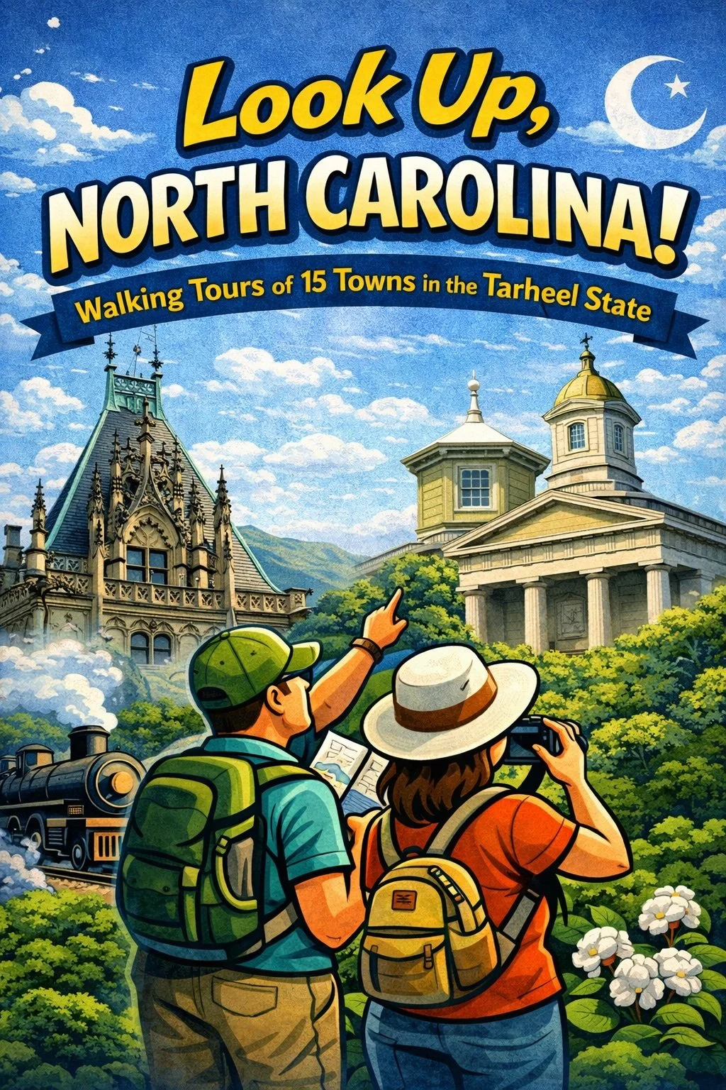
Nestled between the scenic Blue Ridge and Appalachian Mountains in Western North Carolina, Asheville provides visitors with abundant natural beauty as well as historic and cultural diversity. Since the late 19th century, famous architects, landscape designers, and entrepreneurs have recognized Asheville as an area of great promise.
In the early part of the 20th century, Asheville’s pristine environment and clean mountain air became known for its ìhealingî qualities. Tuberculosis hospitals and other places of healing brought many famous Americans to our city including Edwin Wiley Grove and George Willis Pack. Often times they fell in love with the mountains and the city and decided to stay. Much of their early influence can still be seen in the buildings and green spaces around our community including the Grove Park Inn and Pack Square.
Today downtown Asheville, which is known for its early 20th-century architectural treasures is one of the nation’s better small cities for strolling around and gazing at buildings. We will start our walking tour in Pack Square, the public square has been a central feature of Asheville since the town’s creation in 1797...
Montford - no one knows where the name came from - emerged in 1890 when the Asheville Loan, Construction and Improvement Company announced plans to start selling building lots north of town. Asheville was in the early stages of a boomtime that would see the population rise from 2,500 in 1880 to over 50,000 before the onset of the Great Depression in 1930. Montford spread out across 300 acres and by 1893 there were 50 or so people here when the community incorporated as a town. The heady days of independence lasted until 1905 when Montford was swallowed by Asheville and became a city district on the north edge of downtown.
Businessmen and lawyers and doctors moved into Montford - not the ultra-rich but well off enough for homeowners to mimic the popular building styles of the day and for some to hire architects. Most of the homes in Montford were constructed between 1890 and 1920. The earlier homes reflect the late Victorian era with Queen Anne and Shingle Style designs and later structures embraced the Arts and Crafts, Neoclassical and Colonial Revival trends that followed. Montford went into a period of decline in the middle 1900s and bulldozers became an increasingly common sight on the curving, shaded streets. In December 1980, the Asheville City Council designated the Montford Historic District as the city’s first local historic district. There are now four and Montford is the largest, as well as one of the largest in the state of North Carolina. More than 600 century-old structures are now protected. Our journey back into Asheville’s past will travel on patterned-brick sidewalks and we will begin in a slice of greenspace donated by Asheville’s greatest benefactor...
Charlotte was founded in the mid-1700s by Scotch-Irish and Germans traveling down from Pennsylvania. The town and the county were named for Queen Charlotte of Mecklenburg-Strelitz, the wife of King George III of England. Fertile lands drew the early settlers and the nation’s first gold rush - really more of a flurry - took place in the early 1800s after Conrad Reed found a 17-pound rock on his family farm in nearby Cabarrus County that he used as doorstop which turned out to be nearly solid gold. The United States opened the Charlotte Mint in 1837 as the area led the nation in gold production until the great strikes in California in 1848.
Still the population scarcely scraped above 2,000 at the outbreak of the Civil War. After the war the area slowly transitioned from agrarian to manufacturing. The population topped 10,000 for the first time in 1890 as textile manufacturers primed the economy for explosion. By 1930 Charlotte passed Winston-Salem as the largest city in North Carolina and never looked back. Today the population is 750,000. In the process the city seamlessly segued from manufacturing center to financial center and in 2011 only New York City is a bigger banking city.
When a city explodes as quickly as Charlotte there is not much time to argue about preservation and we will only encounter a handful of buildings on our tour that don’t have a modern pedigree. As a counterbalance to the shiny high-rises we will also visit the residential Fourth Ward, mere blocks from the center of downtown, where prosperous merchants and businessmen and doctors built picturesque Victorian houses in the last decades of the 1800s. When this area was ravaged by neglect and abandonment in the 1970s what was left was not bulldozed away but rescued and restored.
Our walking tour will be a mix of commerce and residential, old and new and we will begin in a public greenspace that has survived since Charlotte’s earliest days...
In the early 1850s the steam locomotives of the newly formed North Carolina Railroad could not make the haul between Raleigh and Hillsborough without stopping for more wood and water. Another depot was needed. Established plantation owners in the target area between the two towns were hard sells, however, to get land for a new depot. Finally Dr. Bartlett Durham donated four acres of land for that new station and got the village that sprung up around the tracks named for him.
Not that it was much of an honor at the time - there were fewer than 100 residents in Durham’s Station in 1865 when the two largest intact armies remaining from the Civil War stared down each other from Raleigh (William T. Sherman’s Union troops) and Greensboro (Joseph E. Johnston’s Confederate forces). No fighting would take place, however, as the largest troop surrender of the war was negotiated three miles west of Durham’s Station at James and Nancy Bennett’s farm. While there wasn’t any official fighting there was more than a little looting by the soldiers and one of their favorite booties was a mild flavor of tobacco discovered around Durham. After the veterans returned home many wrote letters to Durham trying to get more of that tobacco. John Ruffin Green was one of the first to fill those orders.
The Duke family home outside Durham was one of those farms stripped bare by marauding Union soldiers as they marched through North Carolina. Family legend has it that a small quantity of bright leaf tobacco was overlooked, providing a tiny lifeline. The family, including 9-year old James Buchanan, gathered the tobacco and sorted it into small packages labeled “Pro Boro Publico.” They hitched their blind mules to a wagon and drove to the southern part of North Carolina where tobacco was scarce. Their small supply sold easily and the money was reinvested into more tobacco. By 1872 the Dukes had sold 125,000 pounds, one of the leading producers in the area. The tobacco was processed in a log house factory in what is now the heart of Duke University.
In 1878, at the age of 22, James Duke took charge of W. Duke & Sons and in 1883 he traveled to New York to introduce his firm to the national tobacco business. Tobacco wars broke out and older companies offered to buy Duke’s company. He had other ideas and consolidated all his competitors under the banner of American Tobacco, with Duke as its president. He was 34 years old.
The Department of Justice broke up the Duke tobacco trust in 1910 and Duke turned to generation of electricity and providing cheap power to the South. Although he himself had little use for education, In 1924 Duke endowed tiny Trinity College with as much as $135,000,000, mostly from his holdings in Southern Power. The school was named after him and became one of the world’s great private universities and forever linking the Duke name with Durham, even after the tobacco factories have long since been converted into condominiums.
Our tour to see how this tobacco town was built will start at the city center at the life-sized, one-ton bronze statue of the city’s emblem, the Durham Bull...
For much of the 1700s Edenton stood in the first rank of towns, not just in North Carolina but in America as well. The town site was one of the first in the colony and in 1722 the village was incorporated and named for Royal Governor Charles Eden. For the next twenty years the royal governor lived here, establishing Edenton as the colonial capital.
Edenton flourished with artisans setting up shop on its streets while goos from across the British empire crossed its docks. While two busy shipyards were turning out considerable ships the town was giving America - and its growing desire for independence - citizens of importance. In 1774, fifty-one women in Edenton signed a protest petition agreeing to boycott English tea and other products. The Edenton Tea Party was the first political action by women in the American colonies and its impact indeed resonated in London.
Other prominent Edentonians included Joseph Hewes, a merchant prince and one of the wealthiest men in the colonies, whose contribution to the cause for independence led to his reputation as the “Father of the American Navy.” James Iredell, an Edenton native, was the youngest member appointed to the first United States Supreme Court by George Washington. A fellow justice, James Wilson, a signer of both the Declaration of Independence and the United States Constitution, was a regular visitor to Edenton and died here in 1798. Samuel Johnston was a local planter and the first United States Senator from North Carolina.
Ultimately, Edenton’s prominence faded rapidly. A hurricane silted the Roanoke Inlet in 1795 and closed the port’s easy access to the sea. When the new-fangled railroad came on the scene a few decades later townsfolk wanted no part of it. The world literally and figuratively passed Edenton by. There would eventually be a cotton mill and the state’s busiest peanut plant but for the most part the tiny town on a peninsula formed by Pembroke and Queen Anne’s creeks went about its business in anonymity.
With the recent emergence of heritage tourism, Edenton’s rich 18th century history suddenly became fashionable. The entire town has been declared an historic district and our hunt for landmarks will begin with a buffeting by the breezes from the Edenton Bay...
Money was the reason for the founding of Fayetteville. As the interior of the Carolinas was being settled in the 1700s merchants on the coast in Wilmington were concerned that the new trade would take place on the Pee Dee River and wind up down in Charleston. They wanted a settlement at the head of navigation on the Cape Fear River, the only navigable waterway entirely in the colony of North Carolina. Scotsmen did the job and the small village of Campbelltown emerged on the banks of the Cape Fear River in 1739. A decade later more Scots established a gristmill and village at Cross Creek, a mile northwest of Campbelltown where, in fact, two streams crossed.
The area became a Tory stronghold as the American colonies moved towards revolution and more than 50 dissenting Whigs gathered in town at Liberty Point on June 20, 1775 and signed resolutions pledging themselves to “resist force by force” and to go forth and be ready to sacrifice our lives and fortunes to secure freedom and safety.” Robert Rowan, an officer in the French and Indian War who settled in Cross Creek as a merchant, became a leader of the Patriot cause and distributed the statement as the “Libert Point Resolves.”
Following the Revolution in 1783 the settlements of Cross Creek and Campbelltown united and were incorporated. Still flush with fervor of patriotism the citizens named the new town Fayetteville, the first to honor the Marquis de Lafayette, major general and top aide to George Washington in the battle for independence. From 1789 until 1793 the General Assembly met in Fayetteville as it served as state capital. The United States Constitution was ratified here and the University of North Carolina chartered. In a vote to create a new state capital, Fayetteville lost out by one vote to legislators who preferred to build a capital from scratch rather than anoint an existing town.
Still, the town prospered into the 1800s, second only to Wilmington in population. Then, on May 29, 1831, sometime around noon a fire started in a kitchen of a house on the northwest corner of Market Square in the center of town. It was a windy day and embers blew from roof to roof of light pine buildings, outpacing the efforts of volunteer firefighters. Four hours later more than 600 homes and 105 stores and businesses had burned. Every church in town, save one, was destroyed. Luckily the fire had started in the middle of the day and everyone was able to escape with their lives. America had never seen anything like it. The entire town was gone. But in an age before federal assistance more than $100,000 in private donations from all over the country was raised and distributed to the Fayetteville people to rebuild.
The river continued to fuel Fayetteville’s economy and the railroads began arriving after 1870 to handle the region’s trade in lumber and textiles. In 1918 Camp Bragg was established as an artillery training ground and following World War I it became a permanent Army post and Fort Bragg, home to several U.S. Army airborne units, has cast its influence on the town ever since. In September 2008, Fayetteville annexed 85% of Fort Bragg, bringing the official population of the city to 206,000.
Our walking tour will begin in the shadow of the likeness of Gilbert du Motier, for whom the town is named...
This area was settled by Quakers, Germans and Scotch-Irish who migrated down from Pennsylvania in the mid-18th century. Independent by nature, these small farmers would prove an asset in the coming Revolution. In 1770 Guilford County was carved from Orange and Rowan counties, taking its name from the Prime Minister of England, the Earl of Guilford. In 1774 a courthouse of hewn logs was raised about five miles northwest of present-day Greensboro.
On March 15, 1781 American forces clashed with the British Army of Lord Cornwallis at the Battle of Guilford Court House. The British carried the day but the cost was so steep Cornwallis pulled his battered army from North Carolina, leading to the eventual surrender at Yorktown. When the General Assembly authorized the creation of a centrally located Guilford County seat in 1808 the new town was named in honor of General Nathanael Greene, commander of the Colonial forces at Guilford Courthouse.
The settlement grew slowly but in the 1840s it had the good fortune to the home of John Motley Morehead when he was the 29th Governor of North Carolina in the early 1840s. Morehead worked tirelessly to build the North Carolina Railroad and made sure the route for the new line passed through his Greensboro. Still, the population of the town would not break out of the hundreds until the 1870s.
By the 20th century, Greensboro was humming. Seeking to take advantage of the town’s growing reputation as a transportation center, brothers Ceasar and Moses Cone established their Proximity (next to the railroad tracks) cotton mill here and soon Greensboro was turning out more denim than anywhere else. The Cone mills were followed by other mills and factories until more than 100 manufacturing concerns were churning out products across Greensboro.
Within about a decade Greensboro exploded from village to city. Virtually nothingremains of that pre-industrial Greensboro in the downtown district but several buildings remain from the hey-day of industrialized Greensboro 100 years ago. But before we find them, our walking tour will start in a very modern urban park, a place no one would have associated with green space just ten years before...
This area was settled by Pennsylvania Quakers as early as 1750 but there was nothing that looked like a town here until 100 years later when the North Carolina & Midland Railroad came through. The town was located at the highest point on the line between Greensboro and Charlotte and became High Point. In 1854 a 130-mile plank road following an old Indian trail and pioneer wagon road was finished between Salem and Fayetteville and crossed here, insuring High Point would develop as a trading center.
High Point was incorporated in 1859. There was early industry in tobacco but neighboring North Carolina towns were more aggressive in its promotion and the importance of High Point’s two tobacco factories faded away. By 1889 word had spread among woodworkers of the abundant hardwoods available nearby and the town’s first furniture factories opened. High Point was on its way to becoming the “Home Furnishings Capital of the World.”
Today the region is home to more than 125 furniture manufacturers, including 15 of the nation’s largest. More than 60% of all the furniture crafted in America comes from within 200 miles of High Point. Twice a year furniture designers, buyers and sellers from more than 100 countries around the world descend on the city forthe International Home Furnishings Market, the largest event of its kind on the planet.
There won’t be many steps on our walking tour when High Point’s furniture heritage is not on display but first we will begin by the railroad where the town earned its name...
There were settlers to this area by 1750 but the small cluster of buildings that passed for a village was so inconsequential no one got around to naming it. When the residents heard tell of the heroic acts taking place in Lexington, Massachusetts they adopted the name Lexington.
The town’s history is a familiar tale in the Piedmont. Some furniture making and some textile manufacturing fueled the economy. But even after the North Carolina General Assembly sliced away a chunk of Rowan County in 1822 and named it after Revolutionary War General William Lee Davidson who fell in the Battle of Cowan’s Ford and selected Lexington as its county seat, great spurts of growth did not follow.
Lexington fancies itself the “Barbecue Capital of the World” and boasts its own style of smoked meat using a vinegar-based red sauce infused with ketchup, pepper and other spices. The sauce also serves as the seasoning base for “red slaw,” which is coleslaw made by using Lexington-style barbecue sauce in place of mayonnaise. Each October the town plays host to the Lexington Barbecue Festival. The event was the brainchild of Joe Sink, Jr., publisher of Lexington’s daily newspaper, The Dispatch, back in 1984. The first festival was a success with 30,000 people feasting on 3,000 pounds of barbecued pork shoulder and has grown five-fold since.
Main Street in Lexington was built mostly between 1880 and 1920. Few buildings from that time have been destroyed, few buildings have been added since. Most have been modernized and altered to suit new tenants so look up to capture the flavor of Lexington a century ago on our walking tour that will begin in the square where the town’s main streets come together...
Englishman John Lawson, Surveyor General of North Carolina, was the driving force behind the founding of New Bern. On March 8, 1705, Bath became the first town incorporated in what was to become North Carolina. Part of the incorporated land was owned by Lawson. He became one of the first town commissioners. In 1709 he published a book about his adventures entitled A Voyage to Carolina.
While back in London to publicize A New Voyage to Carolina, Lawson sweet-talked a Swiss town official, Christoph von Graffenried, into founding a new colony on the Carolina lands. Lawson knew just the spot - a bluff above where the Neuse and Trent rivers flowed. Lured by the promise of cheap land and the dream of silver mines, von Graffenried organized a group of 650 displaced German Palantines hoping for religious freedom to the New World. In January 1710 he sent two ships of settlers ahead. Disease ravaged the expedition and what wasn’t claimed by illness was plundered by a French vessel in the Chesapeake Bay.
Lawson laid out the town with the principal streets in the form of a crucifix, one running northwest from the rivers’ junction and a traverse road, which was fortified with ramparts, running from river to river. When de Graffenried arrived in September 1710 he name the town for his country’s capital, Bern. The settlement was under constant threat by Tuscarora Indians and in 1711 Lawson and de Graffenried were captured while on a canoe trip up the Neuse River. Lawson was tortured to death and de Graffenried freed presumably because he was so well dressed the Tuscarora mistook him for someone who could keep peace (de Graffenried’s being the only account of the incident to survive.)
It was enough for the Swiss who sold his holdings in the enterprise to Thomas Pollock and by 1714 had left these shores forever. The Tuscarora too had been dispatched by this time - defeated and off to New York where they joined the famous Five Nations as the Chautauqua. By the time the town was incorporated as the second n North Carolina in 1723 there wasn’t much Swiss left to it besides the name.
Lawson and de Graffenried’s vision of a prosperous, well-situated town didcome to pass however. It developed into the largest town in the colony and the royal government set up shop here. Busy trade routes between New Bern and Boston and Salem brought an air of New England sophistication to the outpost. Tobacco, molasses, lumber and naval stores kept the docks humming in New Bern through the 19th century.
From an early time the town has never been shy about moving buildings around town in lieu of just tearing them down. Although the waterfront has lost its industrial heritage the wrecking ball has been slow to swing on the streets behind where many landmarks remain from the 18th and 19th century. Our walking tour will seek them out but first we will start at the point that John Lawson picked out 300 years ago...
Raleigh is a member of a very exclusive club: American cities that were founded and planned specifically to serve as a state capital. At the State Convention in 1788 the legislators dismissed the pleas of established towns and instead set out to find a central location for an “unalterable seat of government.” The commissioners headed out to find that perfect location with only one directive - make sure the site is within 16 kilometers of Isaac Hunter’s Tavern, a popular stopping point for the state politicos. Hunter’s land was among 17 tracts inspected but in the end it was 1,000 acres of Joel Lane’s land that was purchased for 1,378 pounds. Tradition holds that Lane’s excellent punch played a part in the transaction.
The new town picked up its name from Sir Walter Raleigh sponsor of the ill-fated “Lost Colony” on Roanoke Island 200 years before. At the same time Raleigh was made the county seat of the newly formed Wake County so there was going to be a lot of governing going on here. In 1792 William Christmas laid out the town grid with a central square that would contain the statehouse and four quadrants anchored by squares named for the firs three North Carolina governors and Attorney General Alfred Moore. By 1794 the brick statehouse was ready and the new government town was off and running. For most of its early existence there was not much more to Raleigh than government. The population in 1840 was actually less than in 1820. That year the railroad arrived which provided a small bump to the economy but there was no boom. The Civil War had little impact on the town and Reconstruction kept industry stagnant another decade. It would not be until 1890 that the population of Raleigh would reach 10,000.
By that time another industry had taken hold in Raleigh: education. The Raleigh Academy had been founded back in 1801 on Burke Square and the first college, Peace Institute had been founded in 1857 but both institutions sputtered. Peace Institute, for instance, would not open until 1872. Three years later, Shaw University, the South’s first African-American college which began classes in 1865, was chartered. In 1887 the North Carolina College of Agriculture and Mechanic Arts, now known as North Carolina State University, was founded as a land-grant college. And in 1891 the Baptist Women’s College, now known as Meredith College, opened its doors. By the turn of the 20th century, the students were out-populating the legislators.
One hundred years further on, the government for which Raleigh was founded is almost incidental. Raleigh is one of the fastest growing cities in the country with a population over 400,000; it is the tenth largest state capital in America. Its industrial base includes banking/financial services; electrical, medical, electronic and telecommunications equipment; clothing and apparel; food processing; paper products; and pharmaceuticals.The city is a major retail shipping point for eastern North Carolina and a wholesale distributing point for the grocery industry.
On our walking tour we’ll see a handful of government buildings early but after that you will probably forget that you are exploring a city whose only reason for being was to be a capital...
With the influx of settlers into the frontier of North Carolina in the 1750s the Colonial Assembly authorized the creation of a courthouse and jail to provide for their justice needs. The location of this new county seat was at the junction of the Great Philadelphia Wagon Road that brought migrants south and the Trading Path that ran east-west. The new town began in February 1755 with James Carter platting the streets in four equal squares. Within a decade there would be about 40 houses and the town, thought to be named for the English cathedral village of Salisbury, would become the biggest and most important town of western Carolina well into the 19th century.
The railroad arrived in 1855 and during the Civil War Salisbury was a Confederate stronghold, staging troops and storing critical supplies. In 1861 an abandoned cotton mill was converted into a prison, first for Confederate deserters and then, notoriously, as a detention center for captured Union troops. The Salisbury Prison became infamous for its deplorable conditions and a target for General George Stoneman who raided the town on April 12, 1865 and burned the prison.
Stoneman, however, issued direct orders not to destroy any private residences or non-military structures and Salisbury emerged from the war in better shape than its Southern neighbors, with the railroad leading the way to recovery. In 1870 the Western North Carolina Railroad had es-tablished its shops in Salisbury and had become the largest single employer. In 1896, thanks to clandestine maneuverings by John Steele Henderson the Southern Railway established its largest steam locomotive facility on the outskirts of Salisbury, spawning a new town named for the first president of the line, Samuel Spencer. The Spencer Shops would employ some 3000 people until the mid 20th century.
Many of the buildings in Salisbury’s Historic District were constructed during this 1900 to 1930 period, the last time Salisbury ranked among the top ten largest cities in North Carolina. But antebellum buildings remain as well, including some that dip into the earliest decades of the 1800s. But our walking tour will begin with the railroad and a building constructed in the years of its greatest influence, when two score trains a day rolled into town...
Tar may have been an important product to the settlers who began building here around 1730. Or the newcomers may have taken the name for their river from the Tuscarora word “Tau,” meaning river of good health.” At any rate when the tiny assemblage of houses tucked into a bend of the Tar River was created in 1760 and designated the county seat of Edgecombe County it was established as Tarborough. Joseph Howell sold 150 acres off his plantation to establish the town. The land was divided into building lots of a half-acre, a small graveyard and a large chunk of fifty acres for public use. The town at the head of navigation on the Tar River prospered enough in the coming years to merit a stop on George Washington.s Southern Tour in 1791.
For much of its early history Tarboro was a small town populated with one-man trades and small businesses. The main line of the new North Carolina railroads ran elsewhere but when spur lines began reaching Tarboro in the latter half of the 1800s, industries were established. There was a cotton mill and a bright leaf tobacco market began in 1891. Tarboro factories manufactured wood products and corn meal and processed peanuts.
In 1977 the Tarboro Historic District was created - a 45-block area peppered with beautifully preserved colonial, antebellum and Victorian homes and original 19th century storefronts. Our walking tour will pass many of the 300 qualifying structures and we will begin with the 15 acres remaining of tat original Town Common...
Wilmington was the largest city in North Carolina until 1910 and even though the population was only 20,000 its position as the state’s leading port brought a sophisticated mix of buildings to its streetscape. That street grid was laid out in 1733 on a bluff overlooking the Cape Fear River, some thirty miles before it flows into the Atlantic Ocean. That bluff made possible an innovation seldom seen in coastal towns - houses with deep foundations and basements.
But the coastal location also meant little stone for building and the reliance on cedar planks meant a town vulnerable to fire and little remains of Wilmington before about 1840. That was the year the Wilmington & Raleigh Railroad opened which unleashed a burst of economic energy that would power the town for the next century. During the Civil War, Wilmington was the chief port of entry for Confederate blockade runners and it was the last port in use by the Confederacy.
The waterfront was stuffed cheek to jowl with piers and warehouses. The wealth that poured across the docks built fine homes only blocks from the river, some that may be recognized by film buffs and television fans. When Italian film director Dino DeLaurentis set up shop in the United States in the 1980s he chose Wilmington and today the city is home to the largest television and movie production facility in America outside California.
Our walking tour will begin in the heart of Wilmington’s historic waterfront, at the spot where Governor William Tryon built his house 250 years ago just steps from the Cape Fear River...
Late in 1802 the Baptist Society purchased an acre of land on which they erected a small church. The tiny community that grew up nearby came to be known as Hickory Grove. In 1839 as the new railroad pushed out from Wilmington towards Weldon a station was built where the rails passed here that was named Toisnot. Gradually the road between Toisnot and Hickory Grove acquired residences and businesses. In the 1848-49 session of the North Carolina General Assembly a bill was introduced to “incorporate Toisnot Depot and Hickory Grove in the County of Edgecombe into a town by the name of Wilson.” The name came from Colonel Louis Dicken Wilson, an area politician who two years prior had taken leave of the North Carolina Senate to command troops in the War with Mexico, contracted yellow fever and died at the age of 58. In 1855 Wilson County was hacked out of Edgecombe, Nash, Johnston and Wayne counties.
Wilson was an agricultural county, tar and turpentine at first and then cotton mostly. There was some tobacco grown - about 2,000 pounds in 1870 passing through town and almost 9,000 pounds in 1880. After that the first tobacco market opened in town and the total passed 1.5 million pounds in 1890. The tobacco boom was on and by 1919 Wilson surpassed Danville, Virginia as the world’s largest market for flue-cured tobacco. By the 1930s the town’s commodious one-story warehouses were handling close to 100,000,000 pounds of bright leaf tobacco in a season.
The tobacco money made its way to Wilson’s streets in the form of civic and commercial and residential buildings. The town has been active in historic preservation and many of the properties from those go-go days remain. Our walking tour will begin at the historic train depot and we’ll keep an eye out for leafy oaks as Wilson has been designated a “Tree City, USA” for more than two decades and earned the nickname, “City of Beautiful Trees...”
In 1741 a small band of Moravian missionaries representing the Unitas Fratrum, founded in 1457 by followers of John Hus and now recognized as the oldest organized Protestant denomination in the world, walked into the wilderness of Pennsylvania and began a settlement on the banks of the Lehigh River near the Monocacy Creek. From the start it was to be a planned community in which property, privacy and personal relationships were to be subordinated to a common effort to achieve a spiritual ideal. On Christmas Eve of that first year the Moravians’ patron, Count Nicholas Ludwig von Zinzendorf of Saxony, Germany, visited the new settlement. Over dinner, the Count christened the community “Bethlehem” to commemorate his visit.
The Moravians were industrious and eager to expand. In 1753 a small party set out from Bethlehem in search of desirable land for a new settlement. After hundreds of miles they came here to “the three forks of Muddy Creek.” The Moravians purchased 98,985 acres for about 35 cents an acre and called their land “der Wachau,” which was the ancestral home of benefactor Count Zinzendorf. It translated into English into the now familiar “Wachovia.” A town was planned at the center of the new lands and tradition holds that the Count again had a hand in the naming, this time picking the name “Salem,” meaning “peace,” just before he died in 1760. Work was begun on the town six years later.
Forsyth County was formed in 1849 and Salem was the obvious choice for a courthouse site. Church elders countered by agreeing to sell land north of town for a new county seat, provided that the streets of the new town be continuous with the streets of Salem. The new community took the name of Major Joseph Winston who won fame on Kings Mountain during the Revolutionary War. Winston grew up as an industrial town, churning out tobacco and furniture and textiles.
The two towns merged in 1913, a political union that left the essential fabric of each town intact. Winston was off on a high-rise building spree befitting its position as the state’s biggest financial center. Salem continued its residential feel along shaded streets. Our walking tour will begin on Salem Square in the heart of Salem where we will see some of the more than 100 buildings from 1766 to 1850 that have been restored or reconstructed on their original sites...